| 0200162678 | 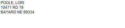 PT LOTS 1 & 2
10471 RD 79 BAYARD NE 69334
31-21-51
2.760 ACRES | PT LOTS 1 & 2
10471 RD 79 BAYARD NE 69334
31-21-51
2.760 ACRES |
| 0200162678 | PT LOTS 1 & 2
10471 RD 79 BAYARD NE 69334
31-21-51
2.760 ACRES |
- Payment Information
-
Select which payment(s) you would like to make and click on continue.
- Deliquency Dates
-
1st Half: 05/01/2021
-
2nd Half: 09/01/2021
| Tax District | 105 | Gross Tax Assessed | $ 2,124.26 |
| Levy | 1.71893100 | Exemption/Credit | $ 126.32 |
| Value | $ 123,580 | Net Tax | $ 1,997.94 |
| Tax Sale(s) | | | |
| Statement Number | 2020-5254 (RE) |
| Tax District | 105 |
| Levy | 1.71893100 |
| Value | $ 123,580 |
| Gross Tax Assessed | $ 2,124.26 |
| Exemption/Credit | $ 126.32 |
| Net Tax | $ 1,997.94 |
| Tax Sale(s) | |
| Net Tax Due | $ 1,997.94 | |
| First Payment | $ 0.00 | Receipt Date 8/31/2021 |
| Second Payment | $ 0.00 | Receipt Date 8/31/2021 |
| Unpaid Tax Due | $ 0.00 | |
| Net Tax Due | $ 1,997.94 | |
| First Payment | $ 0.00 | Receipt Date 8/31/2021 |
| Second Payment | $ 0.00 | Receipt Date 8/31/2021 |
| Unpaid Tax Due | $ 0.00 | |
Receipt date is the business date the payment was posted, not the date received from the taxpayer.