| 0200071974 | 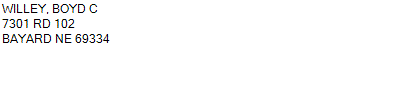 PT NW (N OF RR)
7301 RD 102 BAYARD NE 69334
8-20-52
135.220 ACRES | PT NW (N OF RR)
7301 RD 102 BAYARD NE 69334
8-20-52
135.220 ACRES |
| 0200071974 | PT NW (N OF RR)
7301 RD 102 BAYARD NE 69334
8-20-52
135.220 ACRES |
- Payment Information
-
Select which payment(s) you would like to make and click on continue.
- Deliquency Dates
-
1st Half: 05/01/2017
-
2nd Half: 09/01/2017
| Tax District | 105 | Gross Tax Assessed | $ 6,580.84 |
| Levy | 0.00000000 | Exemption/Credit | $ 342.48 |
| Value | $ 382,350 | Net Tax | $ 6,238.36 |
| Tax Sale(s) | | | |
| Statement Number | 2016-6928 (RE) |
| Tax District | 105 |
| Levy | 0.00000000 |
| Value | $ 382,350 |
| Gross Tax Assessed | $ 6,580.84 |
| Exemption/Credit | $ 342.48 |
| Net Tax | $ 6,238.36 |
| Tax Sale(s) | |
| Net Tax Due | $ 6,238.36 | |
| First Payment | $ 0.00 | Receipt Date 11/6/2017 |
| Second Payment | $ 0.00 | Receipt Date 11/6/2017 |
| Unpaid Tax Due | $ 0.00 | |
| Net Tax Due | $ 6,238.36 | |
| First Payment | $ 0.00 | Receipt Date 11/6/2017 |
| Second Payment | $ 0.00 | Receipt Date 11/6/2017 |
| Unpaid Tax Due | $ 0.00 | |
Receipt date is the business date the payment was posted, not the date received from the taxpayer.