| 0200064072 | 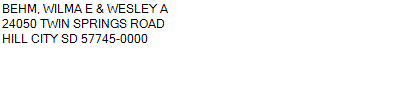 LOTS 1-2-3-4 S1/2NE S1/2NW S1/2 (ALL)
2-21-47
629.000 ACRES | LOTS 1-2-3-4 S1/2NE S1/2NW S1/2 (ALL)
2-21-47
629.000 ACRES |
| 0200064072 | LOTS 1-2-3-4 S1/2NE S1/2NW S1/2 (ALL)
2-21-47
629.000 ACRES |
- Payment Information
-
Select which payment(s) you would like to make and click on continue.
- Deliquency Dates
-
1st Half: 05/01/2013
-
2nd Half: 09/01/2013
| Tax District | 230 | Gross Tax Assessed | $ 2,223.76 |
| Levy | 0.00000000 | Exemption/Credit | $ 97.20 |
| Value | $ 135,934 | Net Tax | $ 2,126.56 |
| Tax Sale(s) | | | |
| Statement Number | 2012-550 (RE) |
| Tax District | 230 |
| Levy | 0.00000000 |
| Value | $ 135,934 |
| Gross Tax Assessed | $ 2,223.76 |
| Exemption/Credit | $ 97.20 |
| Net Tax | $ 2,126.56 |
| Tax Sale(s) | |
| Net Tax Due | $ 2,126.56 | |
| First Payment | $ 0.00 | Receipt Date 4/16/2013 |
| Second Payment | $ 0.00 | Receipt Date 5/31/2013 |
| Unpaid Tax Due | $ 0.00 | |
| Net Tax Due | $ 2,126.56 | |
| First Payment | $ 0.00 | Receipt Date 4/16/2013 |
| Second Payment | $ 0.00 | Receipt Date 5/31/2013 |
| Unpaid Tax Due | $ 0.00 | |
Receipt date is the business date the payment was posted, not the date received from the taxpayer.