| 0200061006 | 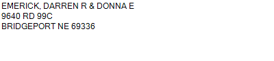 PT SW
9640 RD 99C BRIDGEPORT NE 69336
21-20-50
2.000 ACRES | PT SW
9640 RD 99C BRIDGEPORT NE 69336
21-20-50
2.000 ACRES |
| 0200061006 | PT SW
9640 RD 99C BRIDGEPORT NE 69336
21-20-50
2.000 ACRES |
- Payment Information
-
Select which payment(s) you would like to make and click on continue.
- Deliquency Dates
-
1st Half: 05/01/2013
-
2nd Half: 09/01/2013
| Tax District | 220 | Gross Tax Assessed | $ 1,015.46 |
| Levy | 0.00000000 | Exemption/Credit | $ 44.64 |
| Value | $ 62,413 | Net Tax | $ 970.82 |
| Tax Sale(s) | | | |
| Statement Number | 2012-1934 (RE) |
| Tax District | 220 |
| Levy | 0.00000000 |
| Value | $ 62,413 |
| Gross Tax Assessed | $ 1,015.46 |
| Exemption/Credit | $ 44.64 |
| Net Tax | $ 970.82 |
| Tax Sale(s) | |
| Net Tax Due | $ 970.82 | |
| First Payment | $ 0.00 | Receipt Date 5/3/2013 |
| Second Payment | $ 0.00 | Receipt Date 9/10/2013 |
| Unpaid Tax Due | $ 0.00 | |
| Net Tax Due | $ 970.82 | |
| First Payment | $ 0.00 | Receipt Date 5/3/2013 |
| Second Payment | $ 0.00 | Receipt Date 9/10/2013 |
| Unpaid Tax Due | $ 0.00 | |
Receipt date is the business date the payment was posted, not the date received from the taxpayer.