Payment Detail
Served by
WEBSERVER-2
Sheridan County
0
Parcel
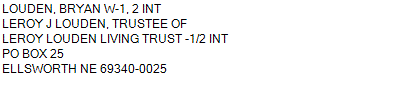
Name
Legal
0810046784
W1/2 27-24-43 (332.53 AC)
332.530 ACRES
W1/2 27-24-43 (332.53 AC)
332.530 ACRES
Parcel
Name/Legal Description
0810046784
W1/2 27-24-43 (332.53 AC)
332.530 ACRES
Payment Information
If the following information is correct click on Add to Cart.
Parcel Information
Tax Information
Tax District
290
Gross Tax Assessed
$ 1,199.32
Levy
0.89095300
Exemption/Credit
$ 179.78
Value
$ 134,611
Net Tax
$ 1,019.54
Tax Sale(s)
Tax Information
Statement Number
2023-4372 (PP)
Tax District
290
Levy
0.89095300
Value
$ 134,611
Gross Tax Assessed
$ 1,199.32
Exemption/Credit
$ 179.78
Net Tax
$ 1,019.54
Tax Sale(s)
Year: 2023 Statement: 4372
Real Estate Tax
Second Payment
509.77
Total Payment
509.77
Payment Information
Second Payment
509.77
Total Payment
509.77