Payment Detail
Served by
WEBSERVER-2
Sheridan County
0
Parcel
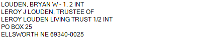
Name
Legal
0810046601
NW1/4, N1/2SW1/4 & SE1/4SE1/4 21-24-43 (285.36AC)
285.360 ACRES
NW1/4, N1/2SW1/4 & SE1/4SE1/4 21-24-43 (285.36AC)
285.360 ACRES
Parcel
Name/Legal Description
0810046601
NW1/4, N1/2SW1/4 & SE1/4SE1/4 21-24-43 (285.36AC)
285.360 ACRES
Payment Information
If the following information is correct click on Add to Cart.
Parcel Information
Tax Information
Tax District
290
Gross Tax Assessed
$ 1,054.68
Levy
0.89095300
Exemption/Credit
$ 158.10
Value
$ 118,377
Net Tax
$ 896.58
Tax Sale(s)
Tax Information
Statement Number
2023-4362 (PP)
Tax District
290
Levy
0.89095300
Value
$ 118,377
Gross Tax Assessed
$ 1,054.68
Exemption/Credit
$ 158.10
Net Tax
$ 896.58
Tax Sale(s)
Year: 2023 Statement: 4362
Real Estate Tax
First Interest
0.00
Second Payment
448.29
Total Payment
448.29
Payment Information
First Interest
0.00
Second Payment
448.29
Total Payment
448.29