Payment Detail
Served by
WEBSERVER-2
Sheridan County
0
Parcel
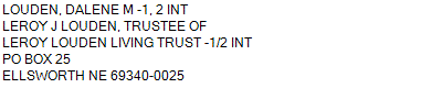
Name
Legal
0810049341
NW1/4NW1/4, S1/2NW1/4, SW1/4, W1/2SE1/4 13-25-43 (369.03AC)
369.030 ACRES
NW1/4NW1/4, S1/2NW1/4, SW1/4, W1/2SE1/4 13-25-43 (369.03AC)
369.030 ACRES
Parcel
Name/Legal Description
0810049341
NW1/4NW1/4, S1/2NW1/4, SW1/4, W1/2SE1/4 13-25-43 (369.03AC)
369.030 ACRES
Payment Information
If the following information is correct click on Add to Cart.
Parcel Information
Tax Information
Tax District
290
Gross Tax Assessed
$ 1,318.88
Levy
0.89095300
Exemption/Credit
$ 197.70
Value
$ 148,029
Net Tax
$ 1,121.18
Tax Sale(s)
Tax Information
Statement Number
2023-4373 (PP)
Tax District
290
Levy
0.89095300
Value
$ 148,029
Gross Tax Assessed
$ 1,318.88
Exemption/Credit
$ 197.70
Net Tax
$ 1,121.18
Tax Sale(s)
Year: 2023 Statement: 4373
Real Estate Tax
First Interest
0.00
Second Payment
560.59
Total Payment
560.59
Payment Information
First Interest
0.00
Second Payment
560.59
Total Payment
560.59