Payment Detail
Served by
WEBSERVER-1
Sheridan County
0
Parcel
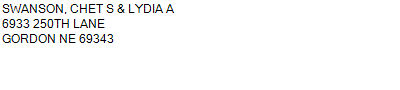
Name
Legal
0810011638
LOTS 6 & 7, E1/2SW1/4, & SE1/4 (S1/2) 6-32-42 (318.61AC)
6-33-42
318.610 ACRES
LOTS 6 & 7, E1/2SW1/4, & SE1/4 (S1/2) 6-32-42 (318.61AC)
6-33-42
318.610 ACRES
Parcel
Name/Legal Description
0810011638
LOTS 6 & 7, E1/2SW1/4, & SE1/4 (S1/2) 6-32-42 (318.61AC)
6-33-42
318.610 ACRES
Payment Information
If the following information is correct click on Add to Cart.
Parcel Information
Tax Information
Tax District
85
Gross Tax Assessed
$ 3,573.74
Levy
1.36227200
Exemption/Credit
$ 329.78
Value
$ 262,336
Net Tax
$ 3,243.96
Tax Sale(s)
Tax Information
Statement Number
2023-7167 (PP)
Tax District
85
Levy
1.36227200
Value
$ 262,336
Gross Tax Assessed
$ 3,573.74
Exemption/Credit
$ 329.78
Net Tax
$ 3,243.96
Tax Sale(s)
Year: 2023 Statement: 7167
Real Estate Tax
First Payment
1,621.98
First Interest
9.95
Second Payment
1,621.98
Total Payment
3,253.91
Payment Information
First Payment
1,621.98
First Interest
9.95
Second Payment
1,621.98
Total Payment
3,253.91