Payment Detail
Served by
WEBSERVER-2
Sheridan County
0
Parcel
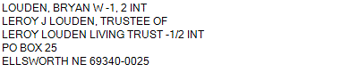
Name
Legal
0810046946
ALL 33-24-43 (635.85 AC)
635.850 ACRES
ALL 33-24-43 (635.85 AC)
635.850 ACRES
Parcel
Name/Legal Description
0810046946
ALL 33-24-43 (635.85 AC)
635.850 ACRES
Payment Information
If the following information is correct click on Add to Cart.
Parcel Information
Tax Information
Tax District
290
Gross Tax Assessed
$ 2,609.96
Levy
0.89095300
Exemption/Credit
$ 391.22
Value
$ 292,939
Net Tax
$ 2,218.74
Tax Sale(s)
Tax Information
Statement Number
2023-4368 (RE)
Tax District
290
Levy
0.89095300
Value
$ 292,939
Gross Tax Assessed
$ 2,609.96
Exemption/Credit
$ 391.22
Net Tax
$ 2,218.74
Tax Sale(s)
Year: 2023 Statement: 4368
Real Estate Tax
First Interest
0.00
Total Payment
0.00
Payment Information
First Interest
0.00
Total Payment
0.00