Taxes Due
Served by
WEBSERVER-1
Kimball County
0
Parcel
Name
Legal
0530152541
TRACT IN SW1/4 32-15-55 (.234 A.) PARENTID# 530018810 CARD #222B
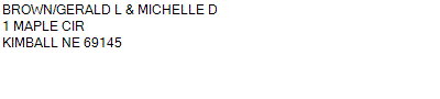
1300 WILSON ROAD KIMBALL NE 69145
0.234 ACRES
TRACT IN SW1/4 32-15-55 (.234 A.) PARENTID# 530018810 CARD #222B
1300 WILSON ROAD KIMBALL NE 69145
0.234 ACRES
Parcel
Name/Legal Description
0530152541
TRACT IN SW1/4 32-15-55 (.234 A.) PARENTID# 530018810 CARD #222B
1300 WILSON ROAD KIMBALL NE 69145
0.234 ACRES
Payment Information
Select which payment(s) you would like to make and click on continue.
Deliquency Dates
1st Half: 05/01/2021
2nd Half: 09/01/2021
Parcel Information
Tax Information
Tax District
40
Gross Tax Assessed
$ 156.28
Levy
2.12478400
Exemption/Credit
$ 7.52
Value
$ 7,355
Net Tax
$ 148.76
Tax Sale(s)
C23-02
Tax Information
Statement Number
2020-530 (RE)
Tax District
40
Levy
2.12478400
Value
$ 7,355
Gross Tax Assessed
$ 156.28
Exemption/Credit
$ 7.52
Net Tax
$ 148.76
Tax Sale(s)
C23-02
Year: 2020 Statement: 530
Real Estate Tax
Net Tax Due
$ 148.76
First Payment
$ 74.38
Second Payment
$ 74.38
Unpaid Tax Due
$ 148.76
Payment Information
Net Tax Due
$ 148.76
First Payment
$ 74.38
Second Payment
$ 74.38
Unpaid Tax Due
$ 148.76
The following conditions prevent you from paying your taxes online.
There is a tax sale on this parcel.
Levy Breakdown
Description
Levy
Tax
COUNTY GENERAL
0.44969100
31.50
KIMBALL #1
1.05000000
73.51
KIMBALL CITY GENERAL
0.40807900
28.57
S.P.N.R.D
0.04888400
3.42
WNCC
0.10176700
7.12
ESU #13
0.01549400
1.08
HISTORICAL SOCIETY
0.00214400
0.15
AG SOCIETY
0.01021000
0.71
KIMBALL AIRPORT GENERAL
0.01698400
1.19
KIMBALL AIRPORT BOND
0.02153100
1.51