| 0530017326 | 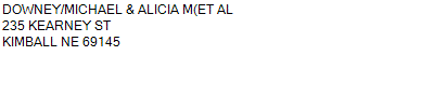 PART OF THE SW 1/4 SOUTH OF THE UPRR 28-15-55 (CONTAINING) 2.591 ACRES (CARD #89)
229 KEARNEY STREET KIMBALL NE 69145
2.420 ACRES | PART OF THE SW 1/4 SOUTH OF THE UPRR 28-15-55 (CONTAINING) 2.591 ACRES (CARD #89)
229 KEARNEY STREET KIMBALL NE 69145
2.420 ACRES |
| 0530017326 | PART OF THE SW 1/4 SOUTH OF THE UPRR 28-15-55 (CONTAINING) 2.591 ACRES (CARD #89)
229 KEARNEY STREET KIMBALL NE 69145
2.420 ACRES |
- Payment Information
-
Select which payment(s) you would like to make and click on continue.
- Deliquency Dates
-
1st Half: 05/01/2021
-
2nd Half: 09/01/2021
| Tax District | 40 | Gross Tax Assessed | $ 369.72 |
| Levy | 2.12478400 | Exemption/Credit | $ 17.78 |
| Value | $ 17,400 | Net Tax | $ 351.94 |
| Tax Sale(s) | | | |
| Statement Number | 2020-1077 (RE) |
| Tax District | 40 |
| Levy | 2.12478400 |
| Value | $ 17,400 |
| Gross Tax Assessed | $ 369.72 |
| Exemption/Credit | $ 17.78 |
| Net Tax | $ 351.94 |
| Tax Sale(s) | |
| Net Tax Due | $ 351.94 | |
| First Payment | $ 0.00 | Receipt Date 7/21/2021 |
| Second Payment | $ 0.00 | Receipt Date 8/31/2021 |
| Unpaid Tax Due | $ 0.00 | |
| Net Tax Due | $ 351.94 | |
| First Payment | $ 0.00 | Receipt Date 7/21/2021 |
| Second Payment | $ 0.00 | Receipt Date 8/31/2021 |
| Unpaid Tax Due | $ 0.00 | |
Receipt date is the business date the payment was posted, not the date received from the taxpayer.