Payment Detail
Served by
WEBSERVER-2
Kimball County
0
Parcel
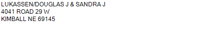
Name
Legal
0530021838
ALL 14-15-57 (CARD #19)
623.920 ACRES
ALL 14-15-57 (CARD #19)
623.920 ACRES
Parcel
Name/Legal Description
0530021838
ALL 14-15-57 (CARD #19)
623.920 ACRES
Payment Information
If the following information is correct click on Add to Cart.
Parcel Information
Tax Information
Tax District
25
Gross Tax Assessed
$ 3,274.48
Levy
1.56666000
Exemption/Credit
$ 279.14
Value
$ 209,010
Net Tax
$ 2,995.34
Tax Sale(s)
Tax Information
Statement Number
2023-2484 (RE)
Tax District
25
Levy
1.56666000
Value
$ 209,010
Gross Tax Assessed
$ 3,274.48
Exemption/Credit
$ 279.14
Net Tax
$ 2,995.34
Tax Sale(s)
Year: 2023 Statement: 2484
Real Estate Tax
First Payment
1,497.67
First Interest
9.19
Total Payment
1,506.86
Payment Information
First Payment
1,497.67
First Interest
9.19
Total Payment
1,506.86