Payment Detail
Served by
WEBSERVER-2
Kimball County
0
Parcel
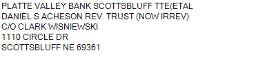
Name
Legal
0530018748
2.31 ACRES IN NW 1/4 NW 1/4 SW 1/4 32-15-55 (CARD #215)**1099 S HWY 71 UNIT A & B
1099 S HWY 71 KIMBALL NE 69145
2.31 ACRES IN NW 1/4 NW 1/4 SW 1/4 32-15-55 (CARD #215)**1099 S HWY 71 UNIT A & B
1099 S HWY 71 KIMBALL NE 69145
Parcel
Name/Legal Description
0530018748
2.31 ACRES IN NW 1/4 NW 1/4 SW 1/4 32-15-55 (CARD #215)**1099 S HWY 71 UNIT A & B
1099 S HWY 71 KIMBALL NE 69145
Payment Information
If the following information is correct click on Add to Cart.
Parcel Information
Tax Information
Tax District
40
Gross Tax Assessed
$ 4,110.60
Levy
1.95933600
Exemption/Credit
$ 233.50
Value
$ 209,795
Net Tax
$ 3,877.10
Tax Sale(s)
Tax Information
Statement Number
2023-3271 (PP)
Tax District
40
Levy
1.95933600
Value
$ 209,795
Gross Tax Assessed
$ 4,110.60
Exemption/Credit
$ 233.50
Net Tax
$ 3,877.10
Tax Sale(s)
Year: 2023 Statement: 3271
Real Estate Tax
First Interest
0.00
Second Payment
1,938.55
Total Payment
1,938.55
Payment Information
First Interest
0.00
Second Payment
1,938.55
Total Payment
1,938.55